|
|
 |
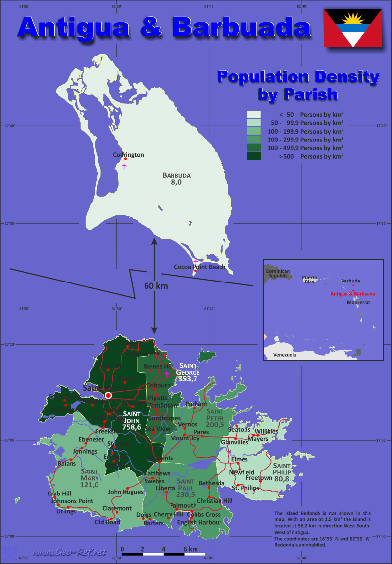
Country map - Administrative structure - Population density of Antigua & Barbuda
Antigua & Barbuda - Click on the map to get a enlarged image in PDF format! Other language versions are easy to generate, the description is in an own layer
Statistical Data - Population density according to the administrative structureThe population data in the table below is a estimation for 2024. Click on the column header brings the table in order of the column header. The default order is the Parish name.
|
||||||||||||||||||||||||||||||||||||||||||||||||||||||||||||||||||||||||||||||||||||||||||||||||||||||||||||||||

 |
If you have suggestions to include other information or you find missed links, please inform us! Click here ... |
International Border disputes
Expand list
Maritime boundaries
- Antigua & Barbuda - United Kingdom - Anguilla
- Antigua & Barbuda - France St. Barts
- Antigua & Barbuda - France - Guadeloupe
See also neighboring states
Dominica - Guadeloupe - Montserrat - Saint Kitts - Saint Martin - Sint Maarten
Fast selection
List of international
organisations
and treaties
Existing
thematical maps
Poulation density for 2024
Link-Collection
Country data
Statistics & Reports - Government Antigua and Barbuda
International data
IOM - International Organization
for Migration
Development cooperation
Special data
External links change quickly - If you get a link error - Please inform us!