|
|
|
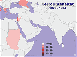
Hardly a topic moves the Western world as strongly as Islamic terror in the last two decades. There are a variety of reports, numbers and tables, also sometimes a geo-referenced representation of the corresponding areas. So here also some examples from this area, which were partly worked up directly for corresponding projects. The first example of an evaluation is the depiction of the terrorist acts from 1970 to April 29, 2017, illustrated in the English Wikipedia version, filtered for the geographical area of the Middle East and the states of the neighbouring regions. The data are very small in the early years - only large assassinations are recorded in the statistics, in the later years and currently also attempted terrorist acts are recorded. An evaluation report is therefore attached.
|
 |
| I refer to the second analysis approach to the
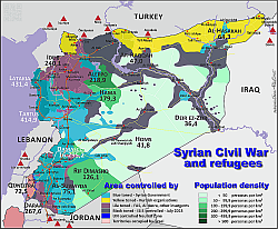
Syrian Civil War. In this, the territorial power relations in Syria are presented in 2015 and 2017.
In addition to this information, the refugee camps in the region - in the neighbouring countries - and their capacity are shown. The two maps show the population density of the Syrian provinces. This is relevant because it varies widely. The western provinces are much more densely populated than the eastern ones. |
 |
|
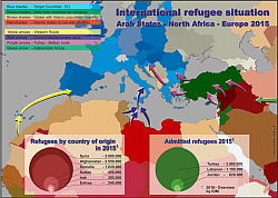
The third example deals with the refugee situation, triggered by the wars in Syria, Iraq, Afghanistan and Africa. The standard flight routes, the composition of refugees by country of origin and the numbers of refugees living in regional camps, Turkey, Lebanon and Jordan are presented. There are also only 2 graphics with values of 2015 and 2017.
|
 |
|
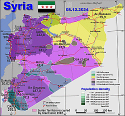
At the end of 2024, the Assad government in Syria was overthrown and
Assad went into exile. According to current
information, the HTS militia achieved all of this in just a few days.
And against a strong professional army. The map of Syria clearly shows how all this is supposed to have happened. But there are more questions than answers. See for yourself - the maps speak for themselves. According to news reports today, the USA is said to have warned other rebel groups weeks ago. |
 |
|
Also interesting: Although not related to the topic of terror, a collection of 24 maps of Europe - from 1789 to 2914, from which the territorial development of the states that exist today can be recognised in their historical development. This is particularly interesting in order to understand the regional differences that still exist today in the ties between individual parts of the country and their own or other states. One example of this is Ukraine, where the eastern parts of the country were under constant Russian control until 1990, while the western parts were largely under Austro-Hungarian or Polish control - making them far more European in orientation. |
 |
Fast selection
This could be
intersting for you
Currently the data of the terrorist acts of
Wikipedia will be completed and will be evaluated in the near
future according to the criteria presented in the
report.
(Report is only in German - but it´s recommended to see it)
External links change quickly - If you get a link error - Please inform us!
