|
|
 |
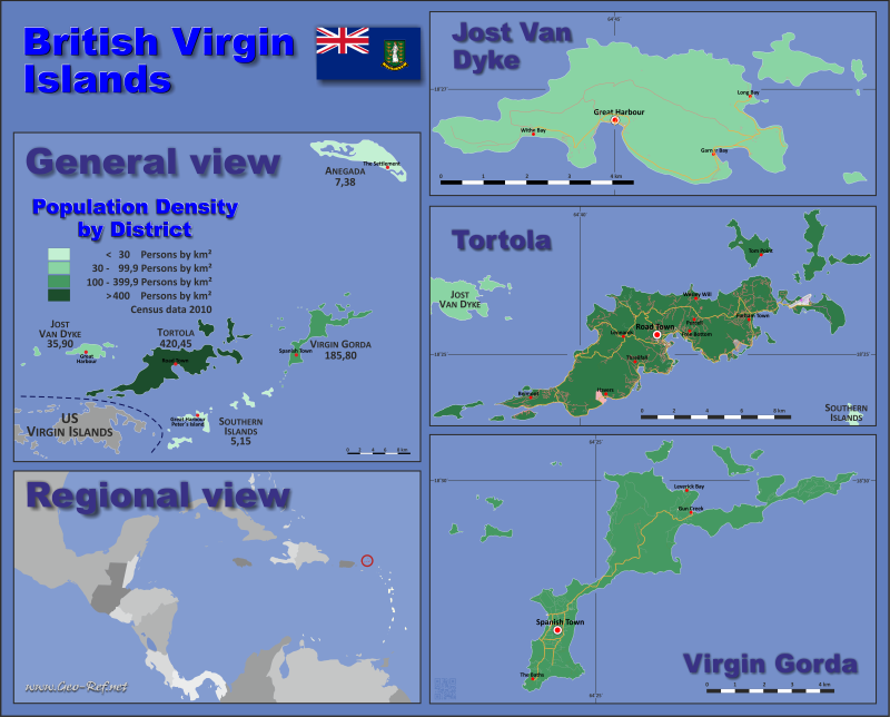
Country map - Administrative structure - Population density of British Virgin Islands
British Virgin Islands - Click on the map to get a enlarged image in PDF format! Other language versions are easy to generate, the description is in an own layer
Statistical Data - Population density according to the administrative structureThe population data in the table below is a estimation for 2024. Currently no ISO 3166-2 codes are defined in the entry for the British Virgin Islands. Click on the column header brings the table in order of the column header. The default order is the District name.
|
||||||||||||||||||||||||||||||||||||||||||||||||||||||||||||||||||||||||||||||||||||||||||||||

 |
If you have suggestions to include other information or you find missed links, please inform us! Click here ... |
International Border disputes
Expand list
See also neighboring states
Anguilla - Great Britain - Puerto Rico - Saba - Saint Martin - Sint Maarten
Fast selection
List of international
organisations
and treaties
Existing
thematical maps
Poulation density for 2024
Link-Collection
Country data
International data
Development cooperation
Special data
External links change quickly - If you get a link error - Please inform us!