Mobil Version header


South Georgia & the South Sandwich Islands

Capital CurrencyGovernment system
King Edward Point Pound Sterling (GBP) Dependent from UK
Official languageRegion Population
English South America 2016 - 35

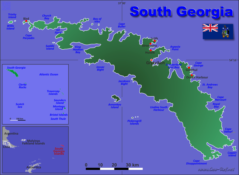
Country map - Administrative structure - Population density of South Georgia Islands

Map South Georgia Islands - Administrative division - Population density 2016

South Georgia Islands - Click on the map to get a enlarged image in PDF format!

Other language versions are easy to generate, the description is in an own layer

Conditions for thematic maps with your own data and logotype
Delivery as printable file by e-mail or plot by post office
Layer 
Province:yes
Streets:yes
Infrastructure:yes
Rivers:yes
Sizebis A2
Supply in7 working days
Price
1 bis 370 €
> 3On request
Buy
All information published herein is free usable quoting the source,
including the maps, if they are not modified

Statistical Data - Population density according to the administrative structure


For South Georgia Islands is no administrative structure defined.


Membership in international organisations and treaties

Expand list

Technical alliances


Broken Link

If you have suggestions to include other information or you find missed links, please inform us! Click here ...


See also neighboring states

Antarctica - Bouvet Island - Falkland Islands - Great Britain


Fast selection


List of international
organisations
and treaties


Existing
thematical maps

  • There exsts only the basic geography.

Link-Collection

Country data

Official Web-Portal

South Georgia & the South Sandwich Islands government

National Media

Wikipedia

CIA - World Factbook


International data

UN-Data


Special data

UN Environment

IRENA
Alternative Energy


External links change quickly - If you get a link error - Please inform us!

Broken Link Report