San Andrés & Providence
| Capital |
Currency | Government system |
|---|
| San Andrés |
Peso (COP) |
Dependent from Colombia |
| Official language | Region |
Population |
|---|
| Spanish |
Central America & Caribbean |
Estimation 2020
63 692 |
Country map - Administrative structure - Population density of San Andrés and Providence
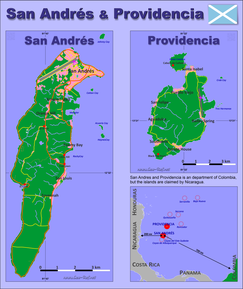
San Andrés and Providence map - Click the map to get map as PDF file.
Other language versions are easy to generate, the descriptions are in own layers
Conditions for thematic maps with your own data and logotype
Delivery as printable file by e-mail or plot by post office
|
|---|
| Layers | |
| Provinces: | yes |
| Streets: | yes |
| Infrastructure: | yes |
| Rivers: | yes |
|
| Size | Till A2 |
| Delivery time | 7 working days | | Price |
| 1 bis 3 | 60 € | | > 3 | On request |
|
 |
All information published herein is free usable quoting the source,
including the maps, if they are not modified
|
|---|
Statistical data - Population density according to the administrative structure
The population data of the table below is an estimation form 2020, last available data.
Click on the column header brings the table in order of the column header.
The default order is the island name.
| Island |
HASC |
Capital |
Area
(km²) |
Population |
Density
(pers/km²) |
| Total |
|
|
44 |
63 692 |
1 447,55 |
|---|
| Last update: 01/16/2024 - 22:32:48 |
|---|
| Providencia |
SA.PR |
Santa Isabel |
18 |
6 259 |
347,72 |
| San Andrés |
SA.SA |
San Andrés |
26 |
57 433 |
2 208,96 |
Existing thematic maps
|
External links change quickly - If you get a link error - Please inform us!
 |
See also neighboring states
|


