Golan Heights
| Capital |
Currency | Government system |
|---|
| Katzrin |
New Shekel (ILS) |
Occupied by Israel |
| Official language | Region |
Population |
|---|
Arabic
Hebrew |
Middle East |
2019 - 47 000/20 500 Israelis |
Country map - Administrative structure - Population density of Golan Heights
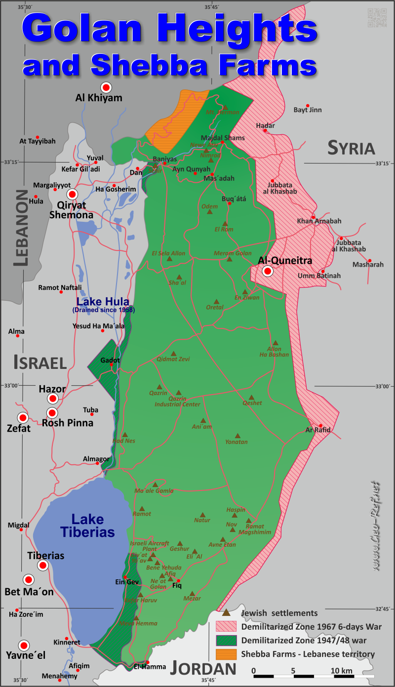
Golan Heights map - Click the map to get map as PDF file.
Other language versions are easy to generate, the descriptions are in own layers
Conditions for thematic maps with your own data and logotype
Delivery as printable file by e-mail or plot by post office
|
|---|
| Layers | |
| Provinces: | yes |
| Streets: | yes |
| Infrastructure: | yes |
| Rivers: | yes |
|
| Size | Till A2 |
| Delivery time | 7 working days | | Price |
| 1 bis 3 | 50 € | | > 3 | On request |
|
 |
All information published herein is free usable quoting the source,
including the maps, if they are not modified
|
|---|
Statistical data - Population density according to the administrative structure
For Golan Heights is no administrative structure defined.
Existing thematic maps
|
External links change quickly - If you get a link error - Please inform us!
 |
See also neighboring states
|


