Somaliland
| Capital |
Currency | Government system |
|---|
| Hargeisa |
Somaliland-Shilling (SQS) |
De facto government |
| Official language | Region |
Population |
|---|
Somalí
Arabic
English |
Africa |
Estimation 2024
5 560 000 |
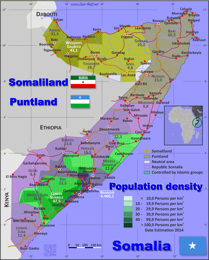
Country map - Administrative structure - Population density of Somaliland
Somaliland map - Click the map to get map as PDF file.
Other language versions are easy to generate, the descriptions are in own layers
Conditions for thematic maps with your own data and logotype
Delivery as printable file by e-mail or plot by post office
|
|---|
| Layers | |
| Provinces: | yes |
| Streets: | yes |
| Infrastructure: | yes |
| Rivers: | yes |
|
| Size | Till A2 |
| Delivery time | 7 working days | | Price |
| 1 bis 3 | 50 € | | > 3 | On request |
|
 |
All information published herein is free usable quoting the source,
including the maps, if they are not modified
|
|---|
Statistical data - Population density according to the administrative structure
The population data of the table below is an estimation form 2024, based on the census 2016.
The statistical data are inaccurate - either derived from the structure of Somalia, or from secondary sources.
Click on the column header brings the table in order of the column header.
The default order is the region name.
| Region |
ISO
3166-2 |
Capital |
Area
(km²) |
Population |
Density
(pers/km²) |
| Total |
|
|
176 120 |
5 560 000 |
31,6 |
|---|
| Last update: 01/02/2026 - 20:37:35 |
|---|
| Awdal |
AW |
Boorama |
21 374 |
1 300 000 |
60,8 |
| Maroodi Jeex |
MJ |
Hargeisa |
14 020 |
1 900 000 |
135,5 |
| Sahil |
SA |
Berbera |
13 930 |
380 000 |
27,3 |
| Sanaag |
SN |
Erigavo |
54 231 |
830 000 |
15,3 |
| Sool |
SO |
Las Anod |
25 036 |
50 000 |
2,0 |
| Togdheer |
TO |
Burao |
31 990 |
1 100 000 |
34,4 |
Existing thematic maps
|
External links change quickly - If you get a link error - Please inform us!
 |
International Border disputes
Expand list
See also neighboring states
|
| |


